How Scientists Solved the Mystery of a 300-Year-Old Megaquake
**The Mystery of a Massive Earthquake 300 Years Ago**
In a coastal area in the Pacific Northwest, standing dead trees, known as the “Copulis Ghost Forest,” are the remnants of a devastating natural disaster. The area was hit by a massive earthquake on January 26, 1700, which triggered a powerful tsunami that swept across the coast and left a deep mark on the landscape.
**The Catastrophe**
Hundreds of years ago, a massive earthquake occurred at the Cascadia Fault, where the Juan de Fuca and North American tectonic plates meet. The ground sank five to six feet, completely changing the terrain and triggering a massive tsunami. The tsunami carried seawater and sediment, covering large areas of land. The submerged trees stood dead, standing as a testament to the devastating event.
**The First Clue**
For centuries, evidence of major earthquakes was based largely on oral histories passed down from generation to generation. However, in the 1980s, geologist Brian Atwater discovered unusual layers of soil on the Washington coast that showed a sudden change in the terrain.
These layers showed that the land had collapsed rapidly and was covered with marine sediments left by tsunamis. But the question remained: When did the earthquake occur?
**Tree Ring Timeline**
To answer this question, Brian teamed up with David Yamaguchi, an expert in tree ring analysis. David used a technique called tree ring comparison to determine when the trees in the Ghost Forest died from the earthquake. By comparing tree rings from living trees with those from dead trees, combined with radiocarbon dating, they determined that the event occurred sometime in the late 17th century, around 1700.
**Evidence from Japan**
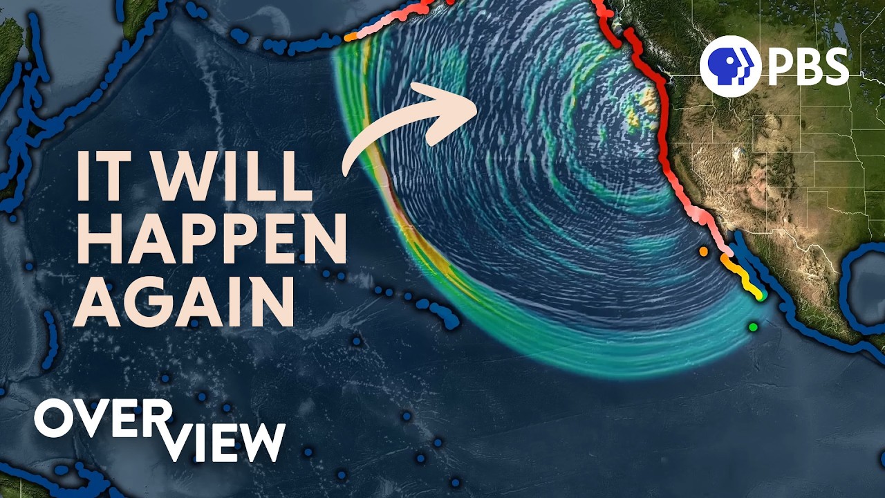
The turning point came from across the Pacific, in Japan. Kenji Satake, a Japanese geologist, found detailed Japanese historical records of a major tsunami on January 26, 1700. These records included the exact time the tsunami reached the Japanese coast.
Calculating the time it took for the tsunami to travel from the Pacific Northwest coast to Japan, Kenji confirmed the exact time of the Cascadia earthquake. This solved the centuries-old mystery of the disaster.
**The Present Danger**
The 1700 Cascadia earthquake is just one of many large earthquakes that could hit the region. At 700 miles long, the Cascadia fault zone has been storing energy for centuries and could release it in the form of a magnitude 8 or 9 earthquake.
Such a quake would cause widespread devastation: major cities from Northern California to British Columbia would be shaken, infrastructure would collapse, millions of people would lose power, water, and transportation. Coastal residents would have only about 15 minutes to get to higher ground before a tsunami hit.
**Preparing for the Future**
Based on historical data, scientists have built tsunami simulation models and created hazard maps for the region. Efforts like the vertical evacuation tower in Tokeland, Washington, built by the Shoalwater Bay Tribe, are offering hope. The tower, which stands 50 feet tall and can accommodate up to 400 people, is fully equipped to assist its residents in the event of an emergency.
In addition, the Shoalwater Bay Tribe has purchased more than 4,000 acres of land to relocate their village to higher ground, safer from tsunamis.
**A Reminder from the Past**
The story of the 1700 Cascadia earthquake is a powerful testament to the power of science and the connections between geology, biology, and history. It reminds us that past disasters can recur, and that it is vital to prepare for the future.


