The most Impossible to Reach places on Google Earth
**Top 10 Inaccessible Places Found on Google Earth – Detailed Overview**
Ten of the most remote, dangerous, and hard-to-reach locations the creator found using Google Earth, explaining the challenges involved in visiting each one. Here’s a detailed summary:
—
**1. Ulakan Sis, Yakutia, Russia**


– **Discovery**: Spotted from a plane in 2012, with little satellite data available.
– **Features**: Unique rock formations create an alien-like landscape.
– **Challenges**: Located deep in the Arctic Circle, with the nearest town 2,000 km away.
– **Hazards**: Polar bears, extreme weather, and logistical issues make visiting extremely risky.
– **Political Restrictions**: Tensions between Russia and the U.S. further complicate access.
—
**2. Vulcán Extinto, Coahuila, Mexico**
– **Description**: A dormant volcano surrounded by intricate canyons, creating a stunning landscape.
– **Limited Information**: Only one photo exists online, with no detailed data about the area.
– **Accessibility Issues**: No nearby towns or paved roads. The rugged environment demands self-sufficiency.
– **Border Concerns**: Its proximity to the U.S.-Mexico border adds another layer of difficulty for visitors.
—
**3. Witjira National Park, South Australia**

– **Significance**: Home to the largest collection of natural springs in Australia, forming a shallow delta that flows through the Outback.
– **Remoteness**: The closest town, Port Augusta, is 887 km away.
– **Challenges**: Days of driving are needed to reach this area. Few visitors explore it due to how isolated it is.
—
**4. Diablo Canyon Nuclear Power Plant, California, USA**

– **Description**: A power plant sitting on a coastline reminiscent of Big Sur.
– **Restricted Access**: The coastline is owned by PG&E, and only one limited hiking trail is open to the public.
– **Visual Interest**: Neon-blue pools at the top of the plant contrast with the surrounding natural beauty.
– **Environmental Impact**: PG&E’s operations recently caused a sediment spill, damaging a major salmon run.
—
**5. Colorado Plateau, Utah, USA**

– **Details**: This part of the plateau is cut off by deep, converging canyons.
– **No Human Presence**: The area shows no signs of trails, buildings, or infrastructure on Google Earth.
– **Navigation Challenges**: The only access point is a dirt road, requiring a capable 4×4 vehicle and careful preparation.
—
**6. Eye of the Sahara (Richat Structure), Mauritania**
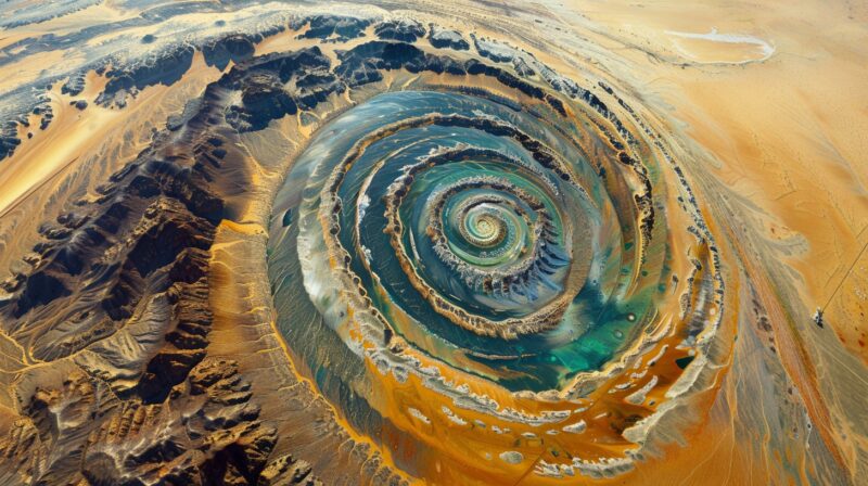
– **Geological Wonder**: A 30-mile-wide circular formation, visible from space.
– **Cultural Significance**: Once thought to be a rainforest 6,000 years ago and possibly an ancient center of human civilization.
– **Journey Difficulty**: Reaching it requires a long, arduous trek across the Sahara Desert. Aerial views are the only practical way to see the entire structure.
—
**7. Giant Footprint Canyon, Utah, USA**
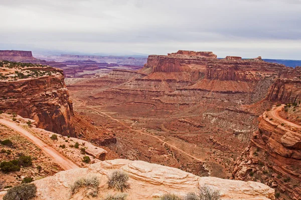
– **Appearance**: Shaped like a footprint, surrounded by an intricate maze of canyons.
– **Trekking Challenge**: Reaching it involves 3-4 days of backpacking, with narrow canyons prone to flash floods.
– **Skill Requirements**: Extensive navigation experience is necessary to avoid becoming lost in the labyrinthine terrain.
—
**8. Ice Canyons of Akshayuk National Park, Canada**
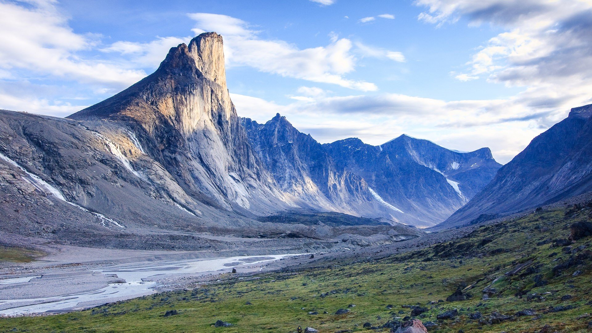
– **Visual Impact**: Massive canyons filled with snow and ice, intersected by blue Arctic waters.
– **Limited Access**: Reaching these canyons requires a snowmobile, boat, or seaplane.
– **Hazards**: The park is home to polar bears, and few areas have been fully explored or photographed.
– **Unique Feature**: Akshayuk Pass is the only well-documented section, leaving much of the park largely unexplored.
—
**9. Capote Falls, Texas, USA**

– **Discovery**: Found accidentally on Google Earth near Big Bend National Park.
– **Description**: A spring-fed waterfall that flows year-round and is possibly the tallest in Texas.
– **Accessibility Issues**: Located on private land with no public access.
– **Viewing Options**:
1. Know the landowner for permission.
2. Risk trespassing and hike 20 miles from the highway (not advised).
3. Charter a plane for an aerial view, though costly and unsatisfying.
—
**10. Nuclear Square Mile, New Mexico, USA**

– **Location**: Hidden within the White Sands Missile Range near the Trinity site.
– **Design**: A perfect 1×1 mile inner square, surrounded by a 2-mile-wide polygon, possibly linked to military functions.
– **Access Difficulty**: Public access is impossible except for a glimpse during tours of the Trinity site, held only twice a year in April and October.
—
These ten locations reflect the thrill of discovery and the challenges of exploring some of the world’s most remote and mysterious landscapes.
